ISO Certifications for Surveying and Mapping Services, Requirements and Benefits
Introduction
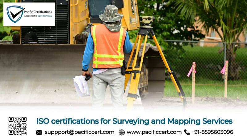
Surveying and mapping services operate in precision-critical environments where professionals deliver topographic surveys, cadastral boundary determination, construction staking, hydrographic surveys, aerial mapping with drones and LiDAR, and geospatial data processing for infrastructure, construction, mining, and environmental applications. These businesses face critical challenges including maintaining measurement accuracy and data quality across diverse terrains and conditions, ensuring field crew safety when working near traffic, construction sites, and hazardous environments, managing expensive equipment calibration and maintenance, and protecting confidential client project information and proprietary geospatial datasets from unauthorized access.
ISO certifications are essential for surveying and mapping services because they provide systematic frameworks ensuring data accuracy, quality control procedures, safety protocols, and professional credibility—requirements increasingly demanded by engineering firms, construction contractors, government agencies, and infrastructure developers. Surveying operations encompass field data collection using total stations, GPS/GNSS receivers, laser scanners, and UAV photogrammetry, office data processing with CAD software, GIS platforms, and 3D modeling tools, quality assurance through measurement verification and error analysis, and deliverable preparation including survey reports, topographic maps, and digital terrain models. The industry faces mounting pressures from professional licensing boards requiring quality management systems, engineering clients mandating ISO certification for consultant approval, construction projects demanding verified accuracy standards, and data protection regulations governing geospatial information security.
In surveying and mapping, measurement precision and data integrity determine infrastructure safety and property rights accuracy.
Quick Summary
ISO certifications provide surveying and mapping services with internationally recognized frameworks to manage service quality through ISO 9001, occupational safety through ISO 45001, environmental impact through ISO 14001, information security through ISO/IEC 27001, risk management through ISO 31000, and laboratory competence through ISO/IEC 17025.
For more information on how we can assist your surveying and mapping business with ISO certifications, contact us at [email protected].
Applicable ISO Standards for Surveying and Mapping Businesses
Below are the most relevant ISO standards applicable to land surveying firms, geospatial mapping companies, engineering survey contractors, and aerial surveying service providers:
ISO 9001: Quality Management Systems (QMS)
ISO 9001 is critical for surveying and mapping firms establishing consistent measurement procedures, systematic quality controls, equipment calibration protocols, and data verification workflows ensuring deliverable accuracy and reliability. This standard helps organizations demonstrate professional competency required for engineering consultant approval, government contract eligibility, and construction project procurement where measurement precision and documentation quality determine project success.
ISO 45001:2018 - Occupational Health and Safety Management Systems
ISO 45001 addresses field safety risks for survey crews working near traffic, construction sites, excavations, waterways, and challenging terrain through systematic hazard identification, safety training, protective equipment requirements, and emergency response procedures. This standard helps surveying firms reduce workplace injuries, manage liability exposures, and comply with occupational safety regulations protecting field personnel during data collection operations.
ISO 27001:2022 - Information Security Management Systems
ISO/IEC 27001 is essential for surveying firms protecting confidential client project plans, proprietary geospatial datasets, infrastructure security information, and intellectual property from data breaches and unauthorized access. With geospatial data often containing sensitive infrastructure locations and security-critical information, this standard provides frameworks for access controls, data encryption, secure file transfer, and incident response protecting client trust and regulatory compliance.
ISO 14001: Environmental Management System (EMS)
ISO 14001 helps surveying and mapping firms manage environmental impacts from field operations, vehicle emissions, waste disposal, and resource consumption through systematic monitoring and reduction programs. This standard supports sustainable surveying practices increasingly demanded by environmentally conscious clients and green infrastructure projects.
Click here to find out more applicable standards to your industry
What are the Requirements of ISO Certifications for Surveying and Mapping Businesses?
Surveying and mapping service providers seeking ISO certification must establish and maintain documented policies, procedures, and records aligned with the selected ISO standards. Key requirements include the following:
ISO 9001:2015 – Quality Management Systems
Establish quality policy defining commitment to measurement accuracy, data quality, client satisfaction, and continuous improvement with measurable objectives aligned with professional surveying standards
Document standardized surveying procedures covering field data collection protocols, equipment setup and calibration verification, measurement techniques for various survey types, data processing workflows, quality control checkpoints, and deliverable review processes
Implement systematic quality controls including redundant measurements for critical points, closure checks for traverse surveys, benchmark verification, data verification procedures, and independent review mechanisms ensuring accuracy
Define equipment calibration and maintenance programs for total stations, GNSS receivers, laser scanners, levels, and drones with documented schedules, calibration certificates, equipment checks, and repair records
Maintain comprehensive project documentation including survey briefs, field notes, raw data files, processing records, quality control results, calculation sheets, final deliverables, and client approval confirmations
Conduct management reviews assessing survey accuracy performance, client satisfaction scores, project delivery timelines, equipment reliability, and continuous improvement initiatives driving operational excellence
ISO 45001:2018 – Occupational Health and Safety Management Systems
Establish hazard identification procedures covering field safety risks including traffic exposure during roadway surveys, excavation hazards near construction sites, terrain hazards on slopes and waterways, weather exposure, and equipment handling injuries
Implement safety controls including high-visibility clothing and traffic control for roadway work, confined space entry procedures, fall protection for elevation surveys, heat stress protocols, and proper lifting techniques for equipment
Define safety training programs covering site-specific hazard recognition, traffic safety procedures, equipment operation certification, emergency response protocols, first aid, and incident reporting requirements for field crews
Maintain vehicle safety programs including driver qualification verification, vehicle inspection procedures, safe driving policies, GPS tracking for emergency response, and journey management for remote field work
Document safety incident reporting systems capturing near-misses, injuries, property damage, and hazardous conditions with root cause investigation, corrective action implementation, and lessons learned communication
Conduct workplace safety inspections evaluating field site conditions, vehicle readiness, equipment safety status, personal protective equipment compliance, and emergency preparedness for survey operations
ISO/IEC 27001:2022 – Information Security Management Systems
Conduct information security risk assessments identifying threats to survey project files, CAD drawings, GIS databases, client infrastructure data, field data backups, and cloud collaboration platforms
Implement access controls including user authentication for data servers, role-based permissions for project folders, password policies, version control systems, and activity logging tracking geospatial data access
Establish data protection procedures covering client confidential project information, infrastructure security data, property boundary information, and proprietary datasets with encryption requirements for storage and transmission
Define cybersecurity incident response plans addressing data breaches, ransomware attacks, unauthorized access to sensitive infrastructure data, and accidental disclosures with client notification and recovery procedures
Maintain vendor security management for cloud storage providers, GIS software platforms, drone data services, printing vendors, and subcontractors with security assessments and confidentiality agreements
Conduct regular security audits, access reviews, and penetration testing identifying and remediating weaknesses in data management systems protecting sensitive geospatial information
ISO 31000:2018 – Risk Management
Establish risk management frameworks identifying surveying risks including measurement errors, equipment failures, field safety incidents, data security breaches, project deadline overruns, and professional liability exposures
Conduct regular risk assessments covering project-specific risks, difficult terrain challenges, weather impacts, technology failures, client specification ambiguities, and legal boundary disputes with likelihood and impact analysis
Implement risk mitigation strategies including measurement redundancy protocols, equipment backup inventories, safety procedures, professional liability insurance, contract clarity, and quality review processes
Define risk monitoring processes with project tracking systems, accuracy verification metrics, safety performance indicators, equipment reliability monitoring, and early warning signals for project challenges
Maintain risk registers documenting identified risks, assessment results, treatment plans, monitoring activities, and risk ownership assignments across field operations, data processing, and client delivery
Integrate risk considerations into project acceptance decisions, survey methodology selection, resource allocation, pricing strategies, and technology adoption ensuring risk-informed decision-making
Tip:Focus on your surveying firm's core quality challenges—typically measurement accuracy assurance, field crew safety, and data security protection—then implement ISO standards addressing these priorities. Document existing calibration procedures, quality control protocols, safety measures, and data management practices, identifying specific areas needing enhancement. This strategic approach delivers measurable credibility improvements while strengthening client confidence in deliverable reliability.
For more information on how we can assist your surveying and mapping business with ISO certifications, contact us at [email protected].
What are the Benefits of ISO Certifications for Surveying and Mapping Businesses?
ISO certifications are suitable for land surveying companies, geospatial mapping service providers, engineering survey consultants, and aerial photogrammetry firms, below are the key benefits:
Enhanced professional credibility and market competitiveness through independent third-party verification of quality management systems
Stronger client confidence and contract retention through systematic quality assurance, documented procedures, and verified accuracy protocols
Improved measurement accuracy and data quality through standardized workflows, calibration protocols, quality control checkpoints, and verification procedures
Better field crew safety and reduced incident rates through systematic hazard identification, safety training, protective equipment requirements, and emergency procedures
Higher data security and intellectual property protection through comprehensive information security controls
Greater market access and premium positioning with ISO 9001 and ISO 45001 certification increasingly required by engineering firms, construction contractors, infrastructure developers, and government agencies for surveyor approval
Reduced operational costs and improved efficiency through process optimization, equipment reliability improvement, waste reduction, and standardized workflows
Enhanced equipment reliability and measurement confidence through systematic calibration programs, maintenance procedures, and ISO/IEC 17025 competence demonstration ensuring accurate, defensible results
Improved regulatory compliance assurance with ISO standards helping ensure adherence to professional surveying standards, licensing board requirements, safety regulations, and data protection laws
Stronger competitive advantage in procurement through verified quality systems, safety performance, and professional capabilities
The global surveying and mapping services market demonstrates steady growth, valued at USD 33.28 billion in recent years and projected to reach USD 58.61 billion in the coming years at 7.3% CAGR, driven by infrastructure development, construction activity growth, technological advancements in GNSS, LiDAR, and drone surveying, and increasing demand for precise geospatial data. Quality system requirements are intensifying with engineering firms, construction contractors, and government agencies increasingly mandating ISO 9001 certification for surveyor qualification and professional credibility verification.
Surveying firms implementing ISO-certified management systems report measurable improvements including enhanced measurement accuracy through standardized procedures reducing errors, improved project delivery reliability and client satisfaction scores, reduced field safety incidents and insurance costs through systematic hazard controls, and strengthened competitive positioning enabling access to major infrastructure and engineering contracts. ISO certification is transitioning from optional to essential, with procurement processes increasingly requiring quality management verification for surveyor approval, advanced technologies including AI-powered data processing and real-time kinematic positioning demanding systematic quality controls, and data security becoming critical amid cloud-based collaboration and digital deliverable transmission.
How Pacific Certifications Can Help?
Pacific Certifications, accredited by ABIS, acts as an independent certification body for surveying and mapping businesses by conducting impartial audits against applicable ISO standards. Our role is to objectively assess whether documented management systems and surveying service practices conform to international ISO requirements, based strictly on verifiable evidence and operational records.
We support surveying and mapping providers through:
Independent certification audits conducted in accordance with ISO/IEC 17021 standards ensuring objective assessment of quality management, safety, data security, and calibration competence systems
Practical assessment of real surveying operations, field data collection procedures, quality control protocols, equipment calibration programs, and safety practices
Clear audit reporting reflecting conformity status, specific findings, observations, and certification decisions based on documented evidence from field operations and office processes
Internationally recognized ISO certification upon successful compliance demonstration supporting engineering consultant approval, government contract eligibility, and client procurement requirements
Surveillance and recertification audits maintaining certification validity and verifying ongoing conformance with evolving standards and operational changes
Contact us
If you need support with ISO certification for your surveying and mapping business, contact us at [email protected] or +91-8595603096.
Author: Jas
Read more: Pacific Blogs